

Abertillery, Blaenau Gwent County Borough


Details
Accessibility
Brief description
https://en.wikipedia.org/wiki/Abertillery

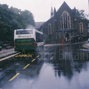
The Pontlottyn - JD Wetherspoon, 14-20 Somerset Street, Abertillery NP13 1DJ
2025; "Abertillery (/ˌæbərtɪˈlɛəri/; Welsh: Abertyleri) is a town and community in Blaenau Gwent County Borough, Wales. It is located in the Ebbw Fach valley, and the historic county of Monmouthshire.
The surrounding landscape borders the Brecon Beacons National Park and the Blaenavon World heritage Site.[2] Formerly a major coal mining centre the Abertillery area was transformed in the 1990s using EU and other funding to return to a greener environment.
Situated on the A467 the town is 15 miles (24 km) north of the M4 and 5 miles (8 km) south of the A465 "Heads of the Valleys" trunk road. It is about 25 miles (40 km) by road from Cardiff and 47 miles (76 km) from Bristol.
According to the 2011 Census, 4.8% of the ward's 4,416 (212 residents) resident-population can speak, read, and write Welsh.[3] This is below the county's figure of 5.5% of 67,348 (3,705 residents) who can speak, read, and write Welsh.[3]
The name of the community means "the mouth of the River Tyleri", which flows into the town. The name Tyleri is probably derived from a personal name.[4]
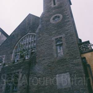
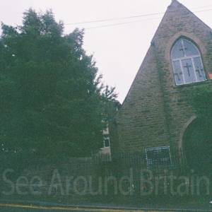
Abertillery's traditional-style town centre mainly developed in the late 19th century and as such has some interesting Victorian architecture. Spread over 4 main streets the town in its heyday had two department stores and a covered Victorian arcade linking two of the main shopping areas. These were all included in a Blaenau Gwent Borough Council remodelling and modernisation project using European Union funding in a £13 million programme spread over a 5-year period ending in 2015.[5]
The project included a new multi-storey car park, a revamp of public areas and the town's Metropole Theatre.[6] This building provides production, exhibition, conference and meeting facilities as well as housing Abertillery museum. In March 2014 Prince Edward, Earl of Wessex, officiated at the launch of Jubilee Square, a public facility in the town centre next to St Michael's Church.[7]
Major industry came to the area in 1843 when the locality's first deep coal mine was sunk at Tir Nicholas Farm, Cwmtillery. The town developed rapidly thereafter and played a major part in the South Wales coalfield. Its population rose steeply, being 10,846 in the 1891 census and 21,945 ten years later. The population peaked just short of 40,000[8] around the beginning of the 1930s. Eventually there were six deep coal mines, numerous small coal levels, a tin works, brick works, iron foundry and light engineering businesses in the area. Just one of the coal mines, Cwmtillery, produced over 32 million tons of coal in its lifetime and at its height employed 2760 men and boys.[9]
In 1960 an underground explosion at Six Bells Colliery resulted in the loss of life of 45 local miners. Fifty years later the archbishop of Canterbury Rowan Williams officiated at the launch of the Guardian mining memorial. This artistically acclaimed monument standing at 20m tall overlooks Parc Arael Griffin, the now reclaimed and landscaped former colliery site. The adjoining Ty Ebbw Fach visitor centre provides conference facilities, a restaurant and a "mining valley" experience room. Not long after the disaster the renowned artist L. S. Lowry visited the area and recorded the scene. The resultant landscape painting now hangs in National Museum Cardiff.[10]
The coal mines remained the predominant economic emphasis until the general run down of the industry in the 1980s.
Away from the town centre, the often steep sided nature of the landscape, imposes its own demands on development. Whilst this sounds limiting it has helped provide the almost amphitheatre nature of Abertillery Park, often described as one of the most attractive rugby grounds in world rugby.[11]
The street plan and housing stock flow uninterrupted from Cwmtillery in the north to Six Bells in the south, forming the town that is Abertillery. Prior to 1974 local government was provided by Abertillery Urban District Council (AUDC).[12] Its area included the small neighbouring villages of Aberbeeg, Llanhilleth and Brynithel. Historical data relating to Abertillery occasionally refers to this AUDC area meaning that it can be difficult to compare like with like. For example, the 2014 population for the wider conurbation area is around 20,000 rather than the 11,000 often quoted for Abertillery itself.
Whilst in the main the area has an older housing stock there are several developments of modern, often large homes, generally found on the outskirts of the town with views out over the surrounding area. These apart, terraced council tax band A and B properties predominate, meaning that average house prices are among the most affordable in the UK."
Address
Tesco Superstore
Tesco Stores Ltd
Castle St
Abertillery NP13 1UR
Phone
Website
https://en.wikipedia.org/wiki/Abertillery
https://www.visitmidwales.co.uk/showmewales/information/product-catch-all/abertillery-p1723221
https://www.bbc.co.uk/news/uk-wales-66994795
https://www.bbc.co.uk/news/articles/c3wqjen1veqo
https://www.bbc.co.uk/news/articles/clynpywddr1o
https://www.bbc.co.uk/news/articles/cg434py9e3go
https://www.geograph.org.uk/search.php?i=6631199
Directions
Opening Times
Always check with the venue directly for up-to-date information including opening times and admission charges as they may be subject to change
Transport
Amenities
Tesco Superstore
Tesco Stores Ltd
Castle St
Abertillery NP13 1UR
+ Tesco Petrol Station
Tesco Stores Ltd
Castle St
Abertillery NP13 1UR
+ Greggs
13 Church St
Abertillery
NP13 1DA
+ The Pontlottyn - JD Wetherspoon
14-20 Somerset Street
Abertillery
NP13 1DJ
+Wyndam Vowles Community Centre
Crown St
Abertillery
NP13 1PJ
+ Abertillery RFC
Abertillery
NP13 1TU
+ Abertillery Park
Abertillery
NP13 1TP
Travel Information
For further travel information in Wales please see: www.traveline.cymru/travel-info
Or call Traveline Cymru on 0800 464 0000
Location
Nearest Venues

Abertillery and District Museum. Free entry.
257 metres*

Oak Street Social Club, Abertillery, Caerphilly
269 metres*
*Distances are calculated in a straight line from the current venue, please allow extra time/distance based on available paths or roads.