

Dunvant, Swansea. Open Daily. Free Admission.


Details
Accessibility
N/A
Brief description
Suburb of Swansea to the West of the City.
https://en.wikipedia.org/wiki/Dunvant
2025: "Dunvant (Welsh: Dyfnant, Dyfn 'deep' and nant 'stream or brook') is a suburban district and community in the City and County of Swansea, Wales, and falls within the Dunvant ward. It is situated in a valley some 4.5 miles west of Swansea city centre. The population as of the 2011 census was 4,383.[1] It adjoins the area of Killay.
Dunvant started out as a small village based around the coal industry. The area between Dunvant and Gowerton was once quite heavily industrialised. with four nearby collieries Killan, Bishwell, Bryn Mawr and Dunvant. Bishwell and Bryn Mawr to the south of Gowerton were short-lived and closed in the 1870s. However, the collieries in Dunvant have a longer history. Dunvant closed again in 1914. Killan ceased operations in 1925 following the disaster of 1924 in which five men were killed. At its peak it employed 900 men. Other industry included the Penlan (Dunvant) Brickworks and Quarry which although long since derelict is now an area of conservation and ecological diversity.
Development of this part of the South Wales Coalfield was due to the proximity of the Central Wales Line, which first opened to passengers in 1867 taking people from Swansea Victoria station via Blackpill through to Gowerton and beyond. At its peak, the railway carried up to 80 trains a day including express trains to Shrewsbury. Houses in the area sprung up in the form of ribbon development along the roads leading to the area in the early 1920s and 1930s. However, it was in the 1960s that larger housing estates appeared, creating the sub-urban area forming Dunvant today."
Address
Dunvant Square, Dunvant SA2 7TA
N/A
Phone
N/A
Website
Social Centre: https://www.facebook.com/DunvantSocialCentre
Directions
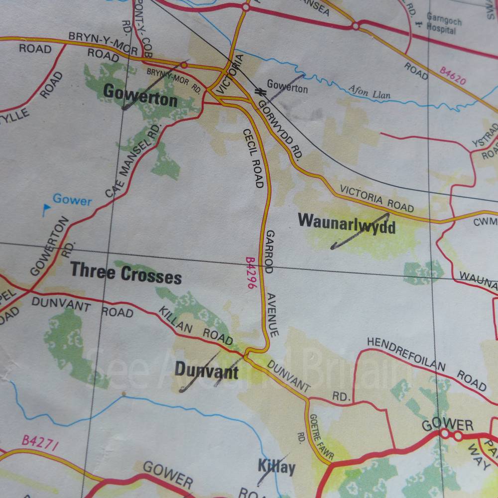
Exit the M4 on Junction 47 and take A483 towards Swansea.
Carry on until you reach a roundabout where take the A484 signposted for Llanelli.
At roundabout take the B4296 left towards Gowerton
Keep on this road across a couple of road junctions until you reach some traffic lights in Gowerton where you meet the B4295, Sterry Road.
Turn left onto B4296 signposted to Dunvant and at the mini roundabout take the third exit to remain on the B4296 towards Dunvant.
Follow this road until you drop down the hill around a long right hand bend to enter the community.
OS SS593937
Opening Times
Daily
Transport
Bus Service numbers 20, 21A and 22 operate through the community.
Nearest Train Station is Gowerton
For more travel information go to https://www.traveline.cymru/ or call 0800 464 00 00
Amenities
Churches
Shop
Social Centre
Post offcie
Patisserie
Primary School
Food Shop Takeaways
Workmens Social Club
Travel Information
For further travel information in Wales please see: www.traveline.cymru/travel-info
Or call Traveline Cymru on 0800 464 0000
Location
Nearest Venues

Dunvant Tandoori, Dunvant, Swansea
62 metres*


Dunvant stores and Dunvant Post Office, Swansea.
392 metres*

One Stop Convenience Store, Dunvant, Swansea
487 metres*

The Dunvant public house, Dunvant, Swansea
516 metres*
*Distances are calculated in a straight line from the current venue, please allow extra time/distance based on available paths or roads.