See Around Britain & Europe Logo
  • Map
  • Language
  • Accessibility
  • About/Help Us
  • How To Use
  • Search
  • Key Facts
  • Basic Travel Needs
  • Help Me (Mayday)
  • Log in

Accessibility options

Font Size

Increase Decrease Reset

Colour Variations

White on Black Yellow Background Reset

Enlarging Images

When viewing a Venue, all of the thumbnails can be enlarged by clicking on them. On mobile devices you can also zoom in further using touch gestures (pinch with two fingers to zoom in and out).

Map Options

Icon Description
Example zoom buttons for map There are options to zoom in and out at the top right of the map (alternatively you can use the mouse scroll wheel or touchscreen gestures)
Example of the layers button for map At the top right of the map there is a layers button which allows you to choose different map styles
❰ Back

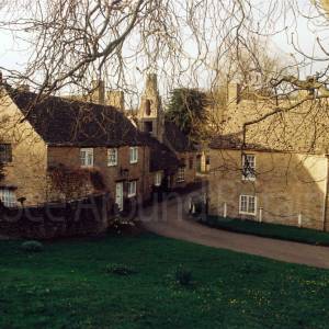
St Mary's Church, Salford, Oxfordshire OX7 5YL


St. Mary's Church, Salford OX7 5YL - A44 and junction to village
St. Mary's Church, Salford OX7 5YL - approach to village
St. Mary's Church, Salford OX7 5YL - Village map and information panel
St. Mary's Church, Salford OX7 5YL - information
St. Mary's Church, Salford OX7 5YL - church from Chapel Lane approach
St. Mary's Church, Salford OX7 5YL - limited on-street parking
St. Mary's Church, Salford OX7 5YL - gate entrance and gravel path

Location:

Nearest Venues:

Salford, Oxfordshire

79 metres*

The Black Horse public house, Lower End, Salford, Oxfordshire OX7 5YW

236 metres*

Barchester - Southerndown Care Home, Worcester Road, Salford, Oxfordshire OX7 5YF

1,489 metres*

The Greedy Goose, Salford Hill, A44, Chastleton, Moreton-in-Marsh, Gloucestershire GL56 0SP

1.14 miles*

Chipping Norton View Point overlooking former Woollen Mill, Oxfordshire

1.21 miles*

Worcester Road Industrial Estate, Chipping Norton, Oxfordshire OX7 5XW

1.32 miles*


*Distances are calculated in a straight line from the current venue, please allow extra time/distance based on available paths or roads.

Our charity urgently needs online volunteers: please go to About/Help Us

Disclaimer: All efforts are made to ensure that any information is correct, but always check with the venue owner in case any details have changed before planning a visit.
All images © Copyright See Around Britain & See Around Europe, all rights reserved. Privacy Policy