

Uxbridge town and local area, London


Details
Accessibility
Google AI:
- The Chimes Uxbridge: Provides designated disabled car parking spaces in the car park with direct access to the mall.
- The Pavilions: Has over 1,000 spaces, including Blue Badge bays, in the Cedars and Grainges car parks.
- Bakers Road Car Park: A public car park located approximately 200 meters from Uxbridge Underground Station.
- Uxbridge Underground Station: Accessible via nearby public car parks. More detailed accessibility information can be found on AccessAble.
- Uxbridge Free Public Library: Designs its website to meet WCAG 2.1 Level AA standards.
- Central Uxbridge Surgery: Aims to make its website accessible to a wide audience, including features for changing colors, zooming, keyboard navigation, and screen reader compatibility."
Brief description
https://en.wikipedia.org/wiki/Uxbridge
2025:
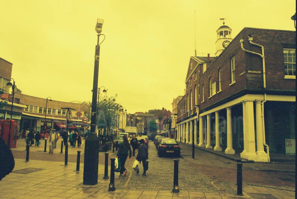
"Uxbridge (/ˈʌksbrɪdʒ/) is a suburban town in west London, England, and the administrative headquarters of the London Borough of Hillingdon, 15.4 miles (24.8 km) northwest of Charing Cross.[2] Uxbridge formed part of the parish of Hillingdon in the county of Middlesex. As part of the suburban growth of London in the 20th century it expanded and increased in population, becoming a municipal borough in 1955, and part of Greater London in 1965.
Attempted negotiations between King Charles I and the Parliamentary Army during the English Civil War took place at a public house called the Crown and Treaty. RAF Uxbridge houses the Battle of Britain Bunker, from where the air defence of the south-east of England was coordinated during the Battle of Britain especially from its No. 11 Group Operations Room, also used during the D-Day landings.
Today the town serves as a significant retail and commercial centre; it also houses Brunel University London as well as a campus of Buckinghamshire New University.[3] A part of the town which has large converted flour mills adjoins Buckinghamshire, the boundary being the River Colne.
According to the 2021 census the population is 17,962"
Address
High St, Uxbridge, UB8 1JX
Phone
Website
https://en.wikipedia.org/wiki/Uxbridge
Directions
Opening Times
Always check with the venue directly for up-to-date information including opening times and admission charges as they may be subject to change
Transport
Uxbridge has an underground station as well as many bus routes.
Amenities
https://choosewhere.com/london-uxbridge-visitor-guide
Travel Information
For further travel information please see: www.traveline.info
Or call Traveline on 0871 200 22 33
(Calls cost 12p per minute plus your phone company's access charge)
NB London ULTRA-LOW EMISSION ZONE
This started on 8 April 2019 in the Central London Congestion Charge Zone, and will extend to the whole of the London area within the
M25 Motorway from 25 October 2021.
For more details please see:
https://tfl.gov.uk/modes/driving/check-your-vehicle-35896
Vehicles registered with a 'disabled' or 'disabled passenger vehicles' tax class will benefit from a grace period after the ULEZ starts until 26 October 2025 as long as their vehicle doesn't change tax class, and this also applies to a 'disabled' vehicle registered outside the UK.
Location
Nearest Venues


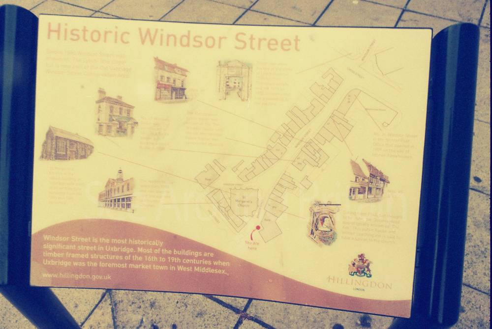
St Margaret's Church, Uxbridge, London
290 metres*

306 metres*

The Gardeners Arms, 119 Park Road, Uxbridge
559 metres*

The Young Ones Nursery, 2 Gatting Way, Uxbridge
736 metres*

St Andrew's Church, Hillingdon Road, Uxbridge
744 metres*
*Distances are calculated in a straight line from the current venue, please allow extra time/distance based on available paths or roads.